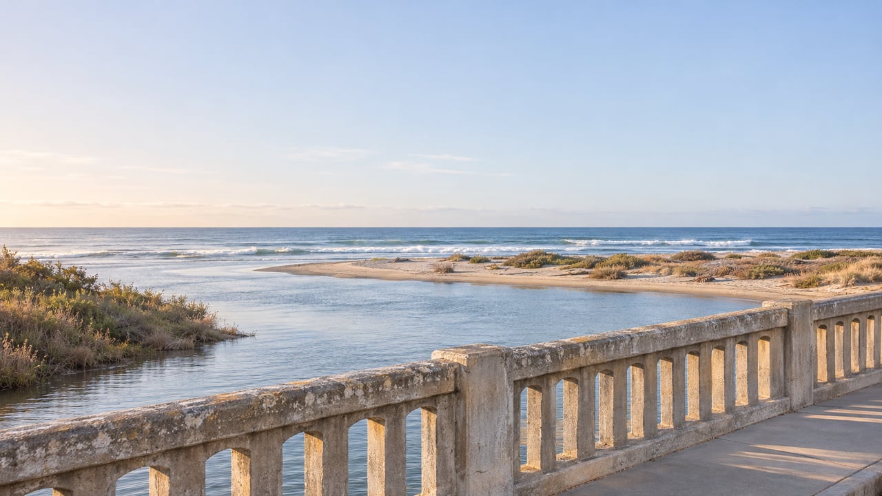
"We're probably never going to have a better opportunity." Councilmember Joy Lyndes, who represents the Cardiff district, said it at the September 9 City Council meeting. As The San Diego Union-Tribune reported, she was talking about the Coast Highway 101 bridge over the San Elijo Lagoon inlet. The opportunity is to add improvements while the city is already repairing the structure.
The improvement most people would picture is easy to name. The bridge has a walkway on each edge. The western one has the ocean views, and the Union-Tribune reported that walkers use it more than the eastern one, even though it is the narrower of the two. Construction is still years off. But the funding rules mean the real decision about that walkway is being made much sooner.
The 200 Feet Between the Kook and Restaurant Row
The bridge is short. The City of Encinitas project page puts it at 200 feet of reinforced concrete on piles. It still matters to anyone heading south along this stretch of 101, because it is the only way across the lagoon mouth between the north end of Cardiff and the restaurants along the beach. Here is the walk, north to south:
- The Cardiff Kook. The Magic Carpet Ride statue stands at 2324 S. Coast Hwy 101. On a visit this August, SFGATE found it dressed as a surfing Stormtrooper.
- San Elijo State Beach campground. The bridge sits just south of the campground.
- The lagoon inlet. This is where tidewater runs under the deck between the lagoon and the ocean.
- Restaurant Row. Cardiff 101's member directory lists Pacific Coast Grill at 2526 S. Coast Hwy 101, Ki's Restaurant at 2591, Cardiff Beach Bar at Tower 13 at 2633 and Las Olas at 2655. Chart House sits between them at 2588.
- Cardiff State Beach. California State Parks describes it as a popular surf spot whose parking lot stays busy all year, and it names Cardiff Reef and Seaside among the beach's access and parking areas.
Cyclists get a separate lane through here. The protected cycle track on the 1.3 miles of 101 from Chesterfield Drive to the Solana Beach border went in in 2020 at a cost of $954,000. It replaced a standard bike lane in each direction with lanes separated from traffic by green flex posts and wheel stops, The Coast News reported. That design was still being debated in 2025. So on the bridge, the bike lanes already have their own space. The walkways are what is left to settle.
Why the Popular Side Is the Narrow Side
The difference between the walkways comes from how the bridge was built. According to the city, the bridge dates to 1934 and was widened on its western side in 1953. The city describes the east-side sidewalk as the ADA sidewalk. Today the deck carries four vehicle lanes and protected bike lanes in both directions, with a pedestrian walkway on each edge.
That puts the ocean-view walkway on the 1953 addition, the newer of the two halves. The wider, accessible sidewalk faces the lagoon. For anyone walking from the Kook toward Las Olas, the better view and the narrower path are on the same side of the bridge.
What "Poor" Means on This Bridge
In January 2026, Encinitas hired Kleinfelder, Inc. to inspect all 46 bridges the city owns or maintains and to draft a 10-year repair plan. Of the 46, only two were rated poor. One is this bridge. The other is the westernmost pedestrian bridge at Leucadia Oaks Park.
Kleinfelder engineer Kelly Burnell explained the rating to the council. As The Coast News reported, she said a poor rating "doesn't mean they're unsafe." It means primary components such as columns or girders are showing deterioration that is "not yet affecting the ability of the bridge to perform." The Union-Tribune listed chipped concrete and rusting rebar among the problems. Burnell also pointed to the location. The Highway 101 bridge is "in a rough spot with the tide running right under it," she said, "and that's hard on bridges."
The city's September 9 council recap says neither poor-rated structure was considered unsafe or at risk of collapse. It names the Highway 101 bridge as the city's highest-priority structure, already set up as a rehabilitation project with federal Highway Bridge Program funding. Caltrans engineers have inspected the bridge regularly, most recently in 2024. It has a sufficiency rating of 60.4 out of 100.
Repair Money and Walkway Money Come From Different Places
The project is funded in a way that puts the walkway question in its own category. According to the Union-Tribune, grants are expected to cover repairs, plus about $3.5 million in city matching money. Anything counted as a major improvement, such as widening the narrow pedestrian walkway, would be a "betterment," and Encinitas would pay the full cost.
The bridge assessment adds a separate planning figure. Its preliminary 10-year capital plan, about $5.9 million citywide, includes $3.8 million to reconstruct this bridge, which the report calls the San Elijo Creek Bridge. The report says these estimates are preliminary and meant for planning.
Engineering Department Director Dan Nutter said the city has to work with Caltrans to set the project's scope, and the main question is what counts as repair and what counts as betterment. That line determines who pays for each part of the work, and it is drawn during scoping, the step the city is in now. This is the timing Lyndes was pointing to. Doing the improvements along with the planned repair is the opportunity she described. She also said she has no doubt residents of the area will want betterments, given how many pedestrians and cyclists cross the bridge every day.
Where the Calendar Stands
The project has been in progress for longer than the September headlines suggest.
| Date | Milestone |
|---|---|
| 2019 | Caltrans staff tell the city the bridge is a good candidate for Highway Bridge Program funding |
| June 24, 2020 | Council authorizes the city to apply for and accept the federal funds |
| June 14, 2023 | Council appropriates partial grant funding and the local match |
| February 2025 | Federal certification of SANDAG's 2025 RTIP, including partial design funding |
| October 6, 2025 | City issues a request for design proposals |
| November 14, 2025 | Six proposals received |
| March 11, 2026 | Council awards the design contract to Dokken Engineering |
| September 9, 2026 | Council receives the citywide bridge assessment |
The March 11 staff report set Dokken's contract at a maximum of $199,817 for design and permitting. It estimated about six months for the first scope of work and about four years for the full design-and-permitting phase. That first scope covers agency and utility coordination, survey work, field inspections and the concept exhibits that go to Caltrans for scope approval. The rest of the design returns to the council after funding is authorized and Caltrans accepts the scope. The contract also allows for up to two council or committee presentations at staff request.
By the staff report's six-month estimate, the concept stage would have run from March into about September. That is the stage where the line between repair and betterment gets drawn. Nutter called the process "arduous," and the Union-Tribune reported that construction could be about five years away, which points to around 2031. So the scope will likely be settled years before any work begins on the deck.
Following the Project From Here
For anyone who crosses the bridge on foot, the place to follow it is the city's San Elijo Lagoon Bridge Rehabilitation page, which links each council action to its agenda report. Kleinfelder's full assessment is posted with the September 9 council materials, linked from the Union-Tribune's coverage. The Council Rundown posts plain-language recaps after each meeting.
For a walk along the lagoon itself, Nature Collective's Nature Center Loop starts at the San Elijo Lagoon Nature Center, 2710 Manchester Ave. Nature Collective describes the loop as flat, wide and even, suitable for wheelchairs and strollers. On December 6, the Nature Center hosts a free Family Fun Day from 10 a.m. to noon, with registration required.
For now, the ocean-view walkway on the 1953 side of the bridge is still the narrow one. Whether that changes depends on the scope Encinitas and Caltrans agree on, well before construction begins.
At The Middleton Team, we follow Cardiff's coastline project by project, because the route from the Kook to Restaurant Row is part of what owners here value about where they live. If you're thinking about what your Cardiff home is worth, we'd be glad to talk it through. List Your Home with a team that knows the neighborhood.